ABOUT WOODWARDIA
welcome
This is one of Mother Nature’s last remaining untouched wild places on Earth.
Woodwardia—530 acres of privately owned coastal Douglas-fir ecosystem, encapsulating a further 400 acres of coastal Crown land with 1,000 more Crown coastal acres in adjacent southern parcels—presents old-growth forest where nature is free to roam.
Situated on the northwest coast of Texada Island in Canada’s west coast Salish Sea, 2,230-acre Woodwardia is a Biosphere Reserve in the making.
Explore how you can visit and learn about this land and its marine life neighbours, research and share knowledge with the next generation, and help preserve this icon of Canadian natural heritage.
M/V Woodwardia
ELEMENTS OF SCIENCE
Working on board a 30-foot Power Catamaran, using an underwater video submarine with visibility to 250 feet depth, and landing ashore for evening meal and accommodation, scientists are invited to explore Woodwardia.
Named after the land adjacent to which she is moored, Woodwardia is a catamaran with ample space from which to conduct science projects exploring the marine environment. A dive tank compressor with snorkeling and scuba diving gear is available. Capturing data on coastal species can help build a picture of the Salish Sea and the health of the environment at our shore.
Islets within 100 meters of Woodwardia are host to hundreds of Steller Sea Lions. Harbour seals and river otters also call the area home, and a large bed of eelgrass supports countless fish in a protected nursery. Orca the largest of the dolphin family, humpbacks and fin whales frequent the area, under the watchful eyes of belted kingfishers, bald eagles and ospreys.

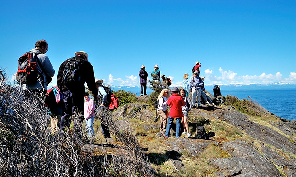
Trails
Woodwardia is host to many trails, allowing the hiker to explore the coastal edge and upland into the heart of the property.
WATERFRONT
Skirting the edge of Woodwardia is the Coastal Trail. This trail takes the hiker to bluffs and beaches, bird nesting colonies and places so remote not even a boat can tether alongside.
The trail begins in the north at Maple Bay. From here, the Upland Trail loops off. At Maple Bay, a person can look out at Seal Rock, an idyllic oasis for sea lions, seals, river otters and mink. The rock is far enough away from the shore to deter predators. It is one of many islets used and enjoyed by nature along this coastline.
The Coastal Trail leads on to Woodwardia headquarters. Its outer edges provide a platform camping spot among Arbutus and a studio cabin upon a bluff.
Heading south from the headquarters, Eagle Cove is next along the Coastal Trail. An eagle’s nest is located here, a bundle of sticks sewn into the upper canopy of a Douglas fir. Then to Otter Point, known also as Favada Point, the most westerly point on Texada Island.
The Trail goes down to Cabin Cove, named as an area for future low-impact sleeping accommodation. Then, onto the Cormorant nesting cliffs, a hive of activity during the spring and early summer as hundreds of cormorants fly in to land and fledge young among these vertical cliff edges.
Copper Beach is next with its tell-tale signs of copper deposits forming a colourful residue secreting from the rocks.
With its undulating rocky outcroppings and deep inset bays, finding somewhere to watch the sunset can be a challenge. But, at the Trail’s next stop, Sunset Beach, the sunset shines right down to a person’s feet. It is a beautiful location to enjoy.
Under the watchful gaze of Vancouver Island’s Forbidden Plateau, the Trail’s next port of call is Woodwardia’s Forbidden Plateau. It was named as such not to be confused with its namesake across the Salish Sea, but rather because it was a relatively unknown spot until about 10 years ago. No human seemed to have been there and even within the past decade, it is an area few have set foot upon.
Another nesting spot, this time for Pigeon Guillemots, is up next. These little birds use holes in the rocks to form their nests and raise the next generation. Their nesting area is in the shadow of the Painted Cliffs. With many minerals found on Texada, this coastal span of rock shows the colourful evidence. When the sun is in the right place, the rock is a fascinating blend that could be captured nicely with a painter’s palette and canvas.
Galapagos is next on the Coastal Trail. With five vernal pools, many animals, birds and amphibians are attracted to the fresh-water source making it a great place to quietly watch wildlife.
Around the corner is Salish Bay, previously Davis Bay. The Coastal Trail follows the bay’s perimeter and first up is a sweet pocket beach with soft pebbles. After that is Timber Beach with dozens of logs washed up at high tide. Then there is the area of Smith’s cabin in Salish Cove. Evidence of the cabin barely exists but a meadowy spot, just up from the beach, is where his home once stood. Climbing up on the south is Salish Bluff with its beautiful views of the Salish Sea. Beyond is Soft Rock Beach, Wedge Rock, Welcome Bay and just after that is Split Cliffs. Here it is possible, for the daring, to step out onto rock which has completely split from the land, yet remains in place…but for how long?
This takes care of the coastal terrestrial pathway, however, Woodwardia is situated within the BC Marine Trails system and is on the proposed Salish Sea Marine Sanctuary and Coastal Trail. The latter is a bioregional watershed protection organization, a joining of Coast Salish nations, British Columbia and Washington State citizens concerned with water purity and restoration of wildlife populations within a healthy habitat.
Trails